Mapping of city properties begins in effort to combat blight
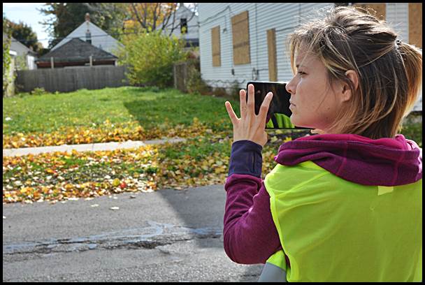
The Motor City Mapping Project began this week in Hamtramck. Workers spent the week recording every property in the city, including a description of what shape each is in.
By Charles Sercombe
The mapping of every single property in Hamtramck began this week.
Workers from Motor City Mapping Project hit the streets and began taking photos of all properties. They also noted brief descriptions of each property, which will in turn eventually be put online for anyone to view at www.motorcitymapping.org.
There are about 7,000 properties to document in Hamtramck. The project should be completed by week’s end.
Motor City Mapping has already documented all of Detroit’s property which will be useful for future development plans and combating blight.
Funding for the project comes from the Knight and Kresge foundations. The emphasis of the project, which also includes Highland Park, is on identifying blighted properties. The method of combining photos and information on blighted properties is being called “blexting” by project organizers.
Kathy Angerer, the city’s Director of Community & Economic Development, welcomed the mapping, saying it will be another “tool” for her to use.
Angerer said she will use the information to immediately identify blighted properties and use that information to secure grants to raze them. The city is coincidentally applying for a state grant to remove blight.
The state has $75 million up for grabs for several area communities, but there is a lengthy process to win part of that grant.